I am retired and have been doing a lot of hiking with my dog Kelley. Kelley has done all the peaks in Acadia National Park as well as those in Camden and the Donnell Pond and Monteville area. We have also done Big and Little Moose, Petit Manan and the Cutler Coast. We hope that other hikers will share hikes they have enjoyed.
So as not to repeat myself excessively, I am reducing the amount of description of trails that have already been posted. Please use the search function ( upper left) to find older posts which have more detailed trail descriptions and pictures. You can also use this to find specific hikes either by trail or mountain.
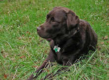
Click Pictures for a Larger View
Friday, January 8, 2010
1/7/10 Narrow Guage Pathway
This is another rails to trails that runs 6.6 miles from the town of Carrabassett to Sugarloaf Ski Resort. We went to the parking area near the town office but could not find the trail head. A man in the town office told us it was actually a mile up an unplowed road and easier access was at Campbell Field. We drove to that trail head and walked back toward the town, ending at the trail head at that end. The first half hour we walked with two men and their young dog and Kelley got to play with that dog until they turned back. This made her very happy. The trail is groomed by the town and so though a little mushy in spots ( they got a lot more snow than we did)was pretty good walking ( if you stepped off the trail you would go in over your knees). Most of the way the trail follows the Carrabassett River but Rte. 16 is the other side of the river so there is some traffic noise that you learn to ignore. We met several skiers ( they have a nice track to one side of the trail) and several dogs. A pretty day though cold and a nice hike for both of us. 3 1/2 hours
Kelley was purchased along with two cats to be companions in a nursing home my wife owned. It became evident that she had a problem with her back legs and had pain. The vet said she had arthritis and she needed to lose weight and get lots of exercise so she came home and we gradually began hiking and put her on a diet. She improved to the point that she had no more pain and had an almost normal gait. When Mary left us we dealt with it by doing even more hiking and immersing ourselves in nature. Kelley did all of the peaks at Acadia as well as most others within a couple of hours of home. And I lost about 20 pounds. She loves to hike and will go as long as I will.
Kelley Update
A bit about how Kelley has been doing. You may be wondering why we are doing shorter and less strenuous hikes. In the story about Kelley above I indicate that the problem with her legs had pretty much been resolved. At the end of August last year I broke my ankle coming down from Dorr Mtn. and was not able to hike for 3 months and then we had a hard winter. This spring Kelley had a return of the arthritis problem in her back legs. She had to go back on medication and we could do little serious hiking. I think she lost some of the strength the vet thought was compensating for her problem. We have been building up the length of our hikes and Kelley is doing better and her medications have been cut way back. I am optimistic at this point that we will get back to the level we had reached before I broke my ankle.
Kelley Update II
Kelley has had a mixture of good days and not so good but overall is doing better. Today ( 10/17) we did a strenuous hike and she was happy and energetic and seems to have tolerated it well, showing no lameness when we got home. I continue to be optimistic - she loves the hiking so much.
Kelley Update 12/31/11
Kelley is doing well, hardly ever exhibits lameness or needs pain medication. She has been very excited the few times we got snow as she really loves to run in it. She seems also to have no problem with cold and is eager to be out in the woods whatever the weather.
1/24/12
Kelley continues to do well with slightly increased mileage. She seems better the more we do.
8/8/15 Update
It's been quite awhile between updates. Kelley is now 8 years old and does not seem to have the limberness she had achieved or the endurance. Occassionaly she lets me know she doesn't want to hike and we have a day off. We have also cut down the time per hike and I have been trying different times and hikes to find the best hikes/time so that she gets her needed exercise but doesn't overdo it. I wish she could talk. We still get out most days and right now an hour and a half seems about right but it's a continuing process.


Snow, sunshine, blue skies, flowing water...doesn't get much better than that. Very picturesque.
ReplyDeleteThanks- it was nice.
ReplyDelete